This week I have two very exciting updates to our digital collections to announce.
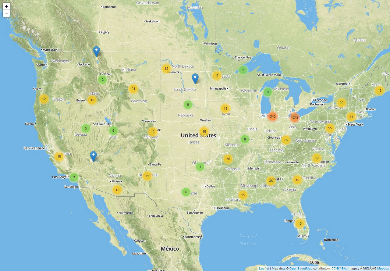
The United States on our postcard map. By default the map is zoomed into Ohio, where most of our cards are.
First is the completion of a map of our current digital postcard collection which you can see here, or get to from the link in the navigation bar at the top of the full collection. This has been a fun project I’ve been working on for a while, and I think it fits the data in our geographically-organized collection perfectly. Each blue pin you see is the location depicted on one of our postcards, and if you click on the pin a popup with a thumbnail and title of the postcard will appear – both the image and words are a link to the postcard in the full collection in CONTENTdm. The colored circles you see are clusters of cards, and if you mouse over the circle you will see the area which it covers. Clicking on the circle will zoom in to that area and show you the distribution of cards on a smaller scale. Many of our cards, especially those in Oxford around Miami, we were able to identify down to the exact building which makes for a pretty exciting map!
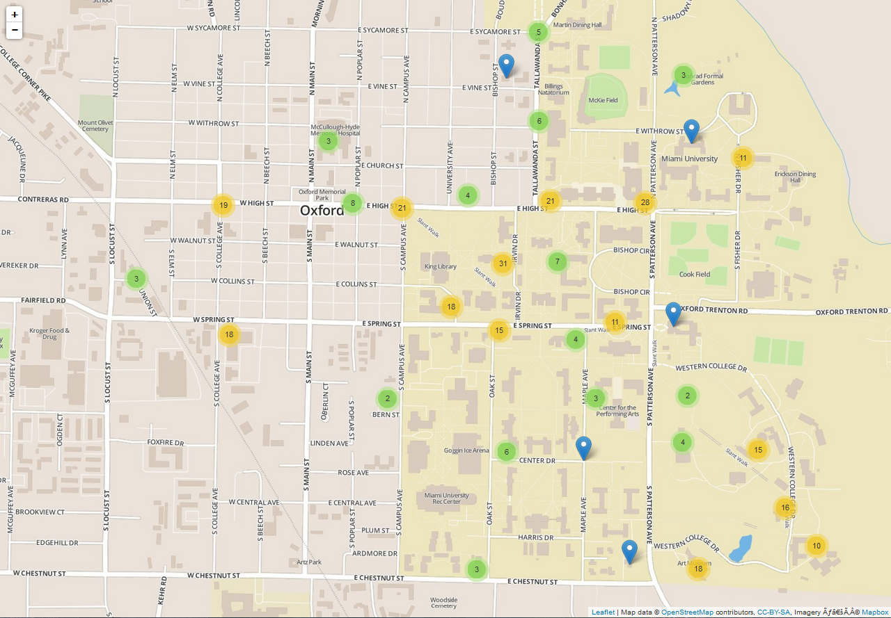
Believe it or not, we have a lot of postcards from Oxford.
The map was made with a combination of PHP scripts and the Leaflet JavaScript library. The first major hurdle I came across was that the CONTENTdm API was not up to the task of being hit thousands of times each time I loaded the map. To work around this, I wrote a PHP script that pulls all the relevant information from the API and stores it in a SQL database on the library’s servers. From this SQL database, I was able to write a second PHP script which makes the actual map by writing a new layer to the map for each row in the SQL database. It took some toying to work out the bugs – and one message to our systems administrator on his day off about an unintentional consequence of one of said bugs (sorry…) – but it’s been great seeing our efforts finally come together.
I’m still working on improving the accuracy of the map, and please note that some of the locations are approximations, but I encourage all of you to explore this new way of visualizing the collection.
The second announcement is the addition of the Carole Gross Colca and Mark Levy collections to the Freedom Summer Text & Photo Archive. The Text & Photo Archive is one of two Freedom Summer digital collections we have (along with the A/V Collection) and features a variety of photographs, newspaper clippings, pamphlets, letters, and other items related to Freedom Summer 1964. The Levy collection, made up of photographs taken by Mark Levy and Donna Garde in Mississippi at the time, was graciously made available to us as duplicates of the originals which are housed in the Civil Rights Archive of the Queens College Special Collections and Archives. Like the Colca materials, the duplicates are kept in the Western College Memorial Archives.
With it being the 50th anniversary this summer – and the memorial conference here in Oxford coming up in October! – this is the perfect time to learn more about this crucial moment in our nation’s history.
Marcus Ladd
Special Collections Digital Librarian